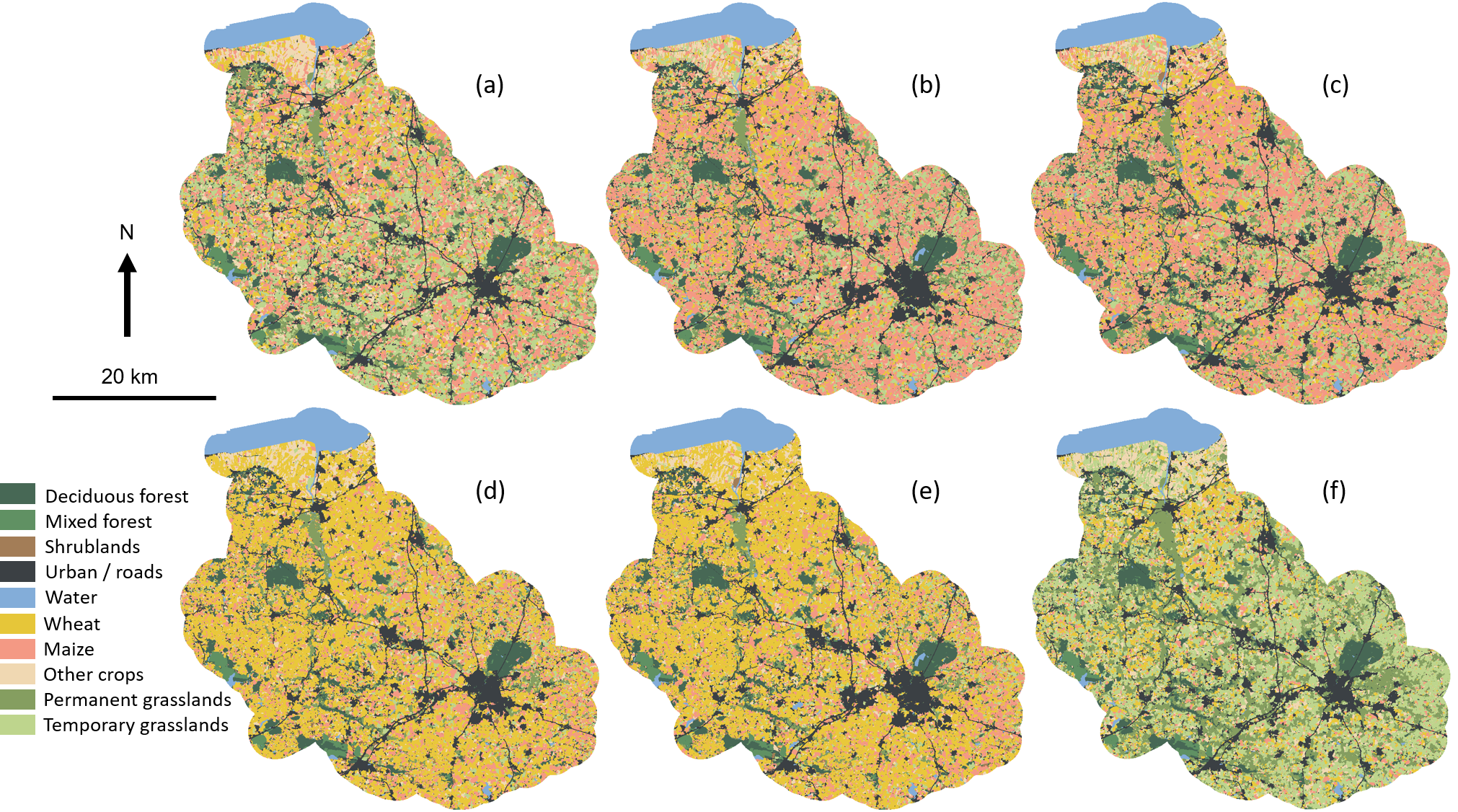
Designing Blue and Green Infrastructure Networks (BGIN) has been recommended as a potential tool for land-use planning to increase ecosystem services while preserving biodiversity. This study focuses on the Couesnon watershed (Brittany, France). It defines and analyzes five possible pathways of future land-use and land-cover changes that include implementation of BGINs. Impacts on biodiversity were estimated by quantifying the change in landscape connectivity. It shows that the EU Common Agricultural Policy can jeopardize the BGINs effectiveness.
The study contributes to local stakeholders’ (farmers, water managers, representatives, etc.) awareness of the stakes of sustainable land management and of the need for integrated policies.
The scenarios were made in: 2020
The scenarios look out to: 2050